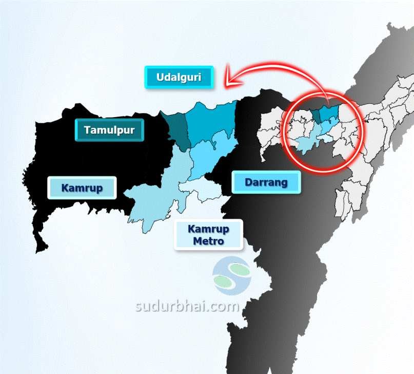
Tamulpur District
INDEX
1. District Overview
2. History of Tamulpur District
3. Geography of Tamulpur District
4. Socio-Economy of Tamulpur District
5. Transport in Tamulpur District
6. Demographics of Tamulpur District
7. Administrative Setup of Tamulpur District
8. Tourist Places in Tamulpur District
9. Languages Spoken in Tamulpur District
Overview of Tamulpur District
- Location: In the Bodoland Territorial Region of Assam, India.
- Established: February 9, 2016, formed from parts of Baksa district.
- Headquarters: Tamulpur town.
- Culture: Known for its diverse culture, agriculture, and natural beauty.

History of Tamulpur District
Formation and Reformation
Initial Formation: Established on January 23, 2022, as Assam’s 35th district, carved out of Baksa district. The Assam Cabinet approved its creation in 2021, with Tamulpur as its headquarters.
Dissolution: Merged back into Baksa on January 1, 2023, before a delimitation process in Assam.
Re-creation: Re-established on August 11, 2023, after the delimitation process, covering Tamulpur and Goreswar Assembly seats.
Administration and Geography
Governance: Administered under the Bodoland Territorial Council (BTC).
Location: Shares 29.6 km border with Bhutan. Terrain includes older river terraces formed by historical river courses.
Historical Background
Kamrup Duars Region: Originally part of Baksa district, located between the Manas and Barnadi rivers.
Bhutanese Rule: Controlled by Bhutan in the mid-17th century.
British Annexation: The British East India Company annexed Banska Dooar and Kamrup Bijni Dooar in the mid-19th century, ending Bhutanese influence.
Geography of Tamulpur District
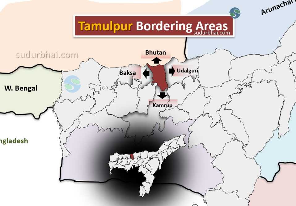
- Area: About 570 square kilometers.
- Boundaries:
- North: Bhutan.
- South: Kamrup district.
- East: Udalguri district.
- West: Baksa district.

Tamulpur Neighbouring districts - Topography: A mix of flat plains and hilly terrains, with fertile agricultural land and wetlands.
- Climate: Humid subtropical, with hot summers and moderate winters.
- Annual Rainfall: Ranges between 2,500 mm to 3,000 mm, with the heaviest rainfall during the monsoon season.
- Impact: Heavy rainfall can cause flooding, but it also improves soil fertility, benefiting agriculture
- Rivers: Pagladia , Baralia , Puthimari and Barnadi.

Socio-Economy of Tamulpur District
- Agriculture: The main occupation. Key crops include rice, jute, mustard, and various vegetables. The district also grows oranges and bananas.
- Livestock Farming: Includes cattle, goats, and poultry.
- Small-scale Industries: Limited industries, including food processing and bamboo crafts.
- Trade and Commerce: Agriculture is the backbone, and local markets support the trade of agricultural products.
Transport of Tamulpur District
- Roadways: State highways link the district to other parts of Assam.
- Railways: The nearest railway station is in Rangia, around 20 km away.
- Airways: The nearest airport is in Guwahati, about 70 km from Tamulpur, connecting the region to major cities across India.
Demographics of Tamulpur District
- Total Population: 403,507
- Males: 204,886
- Females: 198,621
- Sex Ratio: 970 females per 1000 males
- Urbanization:
- Rural: 383,519
- Urban: 5,631 (1.45% of the total population)
- Population Group:
- Scheduled Castes: 43,319 (10.86%)
- Scheduled Tribes: 125,426 (31.17%)
- Not indigenous: 234,762
- Literacy (Age 7+):
- Literate: 237,264
- Illiterate: 133,828
- Age Groups:
- 0-6 years: 53,806
- 7+ years: 349,701
- Religion:
- Hinduism: 83.36%
- Islam: 12.97%
- Christianity: 3.22%
- Other or not stated: 0.45%
- Total Population: 403,507
Administrative Setup of Tamulpur District
- District Headquarters: Tamulpur town.
- Sub-Divisions: One sub-division called Tamulpur.
- Revenue Circles: Two revenue circles – Tamulpur Circle and Goreswar Circle.
- Development Blocks: Three blocks – Tamulpur, Goreswar, and Nagrijuli.
Attractive Tourist Places in Tamulpur District
- Bogamati: A picturesque spot by the Barnadi river near the Indo-Bhutan border, popular for picnics
- Manas National Park: This world-famous national park falls within the Baksa district, which historically includes the area of Tamulpur. It is known for its natural and ecological importance, and is a UNESCO World Heritage Site
- Historical River Terraces: In some areas of Tamulpur, you can see older river terraces that were formed by historical river activity
Languages Spoken in Tamulpur District
- Assamese: 36.96%
- Boro: 25.40%
- Bengali: 22.33%
- Nepali: 5.18%
- Santali: 4.67%
- Sadri: 0.96%
- Rajbongshi: 0.93%
Let us know any further suggestions ,we at sudurbhai.com will be happy to hear from you in our comment section below !
