
- Location: Western part of Assam, India.
- Area: Approximately 1,093 square kilometers.
- Boundaries:
- North: Chirang
- East: Barpeta
- South: Goalpara
- West: Dhubri
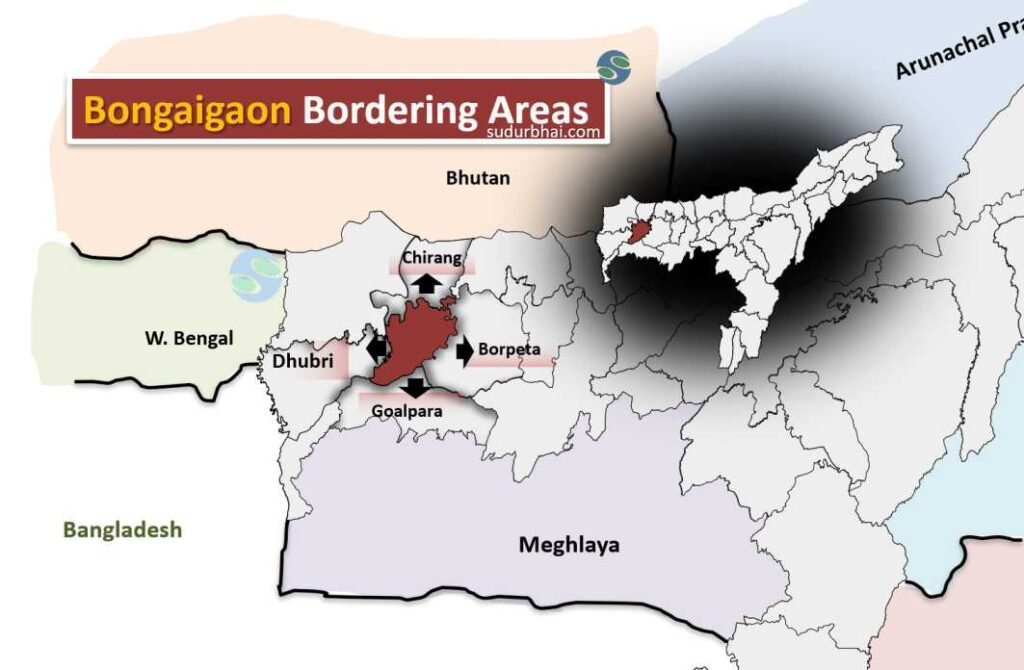
Bongaigaon bordering districts
- Terrain: Mix of plains and hilly terrains.
- Beel : Dalani, Tamaranga, Kanora etc.
- Geographical Features: Rich biodiversity and fertile land, making it suitable for agriculture.
- Climate: Subtropical.
- Average Annual Rainfall: Ranges from 250 cm to 350 cm.
- Monsoon Season: Most precipitation occurs from June to September, supporting agricultural activities.
- Rivers: The Brahmaputra River (forming southern boundary) , Manas, Champamati, Aie, Mara Manas.
