Biswanath District

Biswanath District

1. Creation

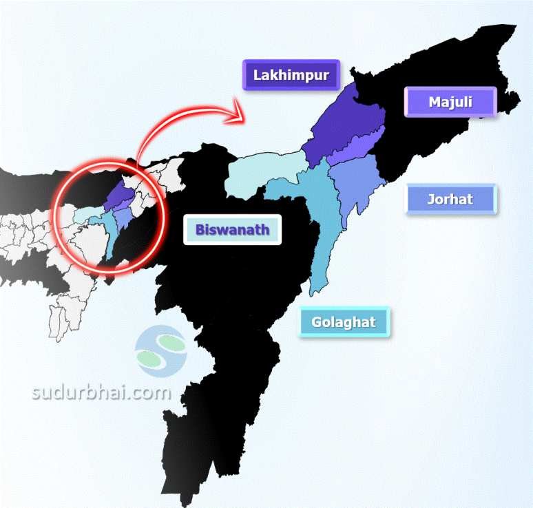
    • Formed on August 15, 2015, by bifurcating parts of Sonitpur district.
    • Includes Gohpur and other areas.

2. Headquarters

    • Located in Biswanath Chariali.

3. Historical Significance

    • Part of historical kingdoms: Chutiya and Ahom.
    • Home to Biswanath Temple, known as “Gupta Kashi” for its spiritual value.

  History of Biswanath District

Ancient & Medieval History of Biswanath

1. Chutiya & Ahom Kingdoms
        • Chutiya Kingdom ruled most of Biswanath until the 16th century.
        • Ahoms annexed the region, while Bhuyan chieftains controlled the western parts.
        • Major rivers like Dikarai & Ghiladhari marked kingdom boundaries.
2. Fortifications
        • Chutiya kings built Buroi Fort & Pratapgarh Fort for defense.
        • These forts indicate Biswanath’s strategic importance in medieval Assam.

  Geography of Biswanath District

1. Location

    • North bank of the Brahmaputra River.
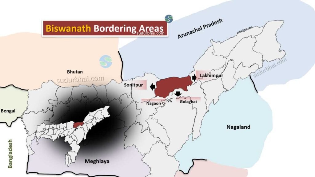
    • Borders:
      • North: Arunachal Pradesh
      • East: Lakhimpur district
      • South : River Brahmaputra
      • West : Sonitpur district
        Biswanath district
        Biswanath neighbouring districts

2. Topography

    • Predominantly flat and fertile plains, ideal for agriculture.
  •  

3. Rainfall in Biswanath District

    • Climate: Subtropical monsoon climate.
    • Average Annual Rainfall: Approximately 1,800 mm.
    • Monsoon Season: Most precipitation occurs from June to September, which supports agricultural activities.

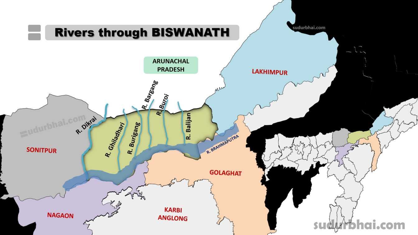
4. Rivers :

    • River Brahmaputra (southern Border) , Ghiladhari , Bargang , Buroi , Burhiganga , Dikrai and Balijan.
Rivers through Biswanath
Rivers through Biswanath District

  Socio Economy of Biswanath District

1. Agriculture

      • Primarily agrarian economy with significant tea cultivation.

2. Credit Potential

      • Focus on MSMEs, including agriculture and renewable energy sectors.

3. Employment

      • Majority dependent on agriculture and related activities.
      • Industries: Small-scale industries and handicrafts contribute to the local economy.

  Transport of Biswanath District

    • Transportation Hub: Biswanath Chariali serves as the main town and transport hub.
    • Road Connectivity: National Highway 15 runs through the district, linking it to major cities in Assam.
    • Waterways: The Biswanath multimodal waterways terminal on the Brahmaputra River enhances trade and transportation.
    • Major stations:
      • Dubia
      • Gohpur
      • Brahmajan
      • Helem
      • Niz Borgang
      • Monabari
      • Biswanath Chariali
      • Niz Sotea

  Demographics of Biswanath District

Population Overview

    • Total Population: 612,491

      • Male Population: 311,234

      • Female Population: 301,257

    • Sex Ratio: 968 females per 1000 males

Urban and Rural Distribution

    • Urban Population: 31,368 (5.12%)

    • Rural Population: 581,123 (94.88%)

Age Distribution

    • Children (0-6 years): 88,453

Literacy Rates

    • Overall Literacy Rate: Approximately 75.41%

      • Male Literacy Rate: 81.36%

      • Female Literacy Rate: 69.06%

Scheduled Castes and Scheduled Tribes

    • Scheduled Castes (SC): 43,763 (7.15%)

    • Scheduled Tribes (ST): 93,174 (15.21%)

Religious Composition

    • Hinduism: 514,259 (83.96%)

    • Islam: 52,155 (8.52%)

    • Christianity: 42,408 (6.92%)

    • Others/Not Stated: Approximately 0.60%

 Administrative Setup of Biswanath District

  1. Administrative HQ: Biswanath Chariali.
  2. Sub-Divisions:
    Includes Biswanath Chariali and Gohpur
  3. Revenue Circles/Tehsils:
    Biswanath Chariali, Gohpur, and Helem.
  4. Development Blocks:

      • Includes Pub-Chaiduar and Behali blocks.
      • Gohpur holds historical significance in India’s freedom struggle.
      • On September 1942, freedom fighters Kanaklata Barua and Mukunda Kakati were martyred.
      • They were killed in police firing while attempting to hoist the national flag at Gohpur Police Station.

 Attractive Tourist places of Biswanath District

    • Biswanath Temple: A significant pilgrimage site, also called “Gupta Kashi.” (Located at confluence of Burhiganga River and Brahmaputra River)
    • Eco-Tourist Resort at Uma Tumoni Island: Scenic beauty and recreational activities.
    • Historical Sites: Various archaeological sites and historical landmarks reflecting the region’s heritage.
    • Biswanath Ghat has been selected as the Best Tourism Village of India 2023 by Ministry of Tourism

 Languages spoken in Biswanath District

      • Assamese (34.06%)
      • Sadri (13.56%)
      • Bengali (8.58%).
      • Nepali: 7.93%
      • Boro: 7.23%
      • Mising: 7.09%
      • Other Languages: Includes Hindi and various tribal dialects.

Let us know any further suggestions ,we at sudurbhai.com will be happy to hear from you in our comment section below ! 

1 thought on “Biswanath District”

Leave a Comment

Your email address will not be published. Required fields are marked *

Scroll to Top