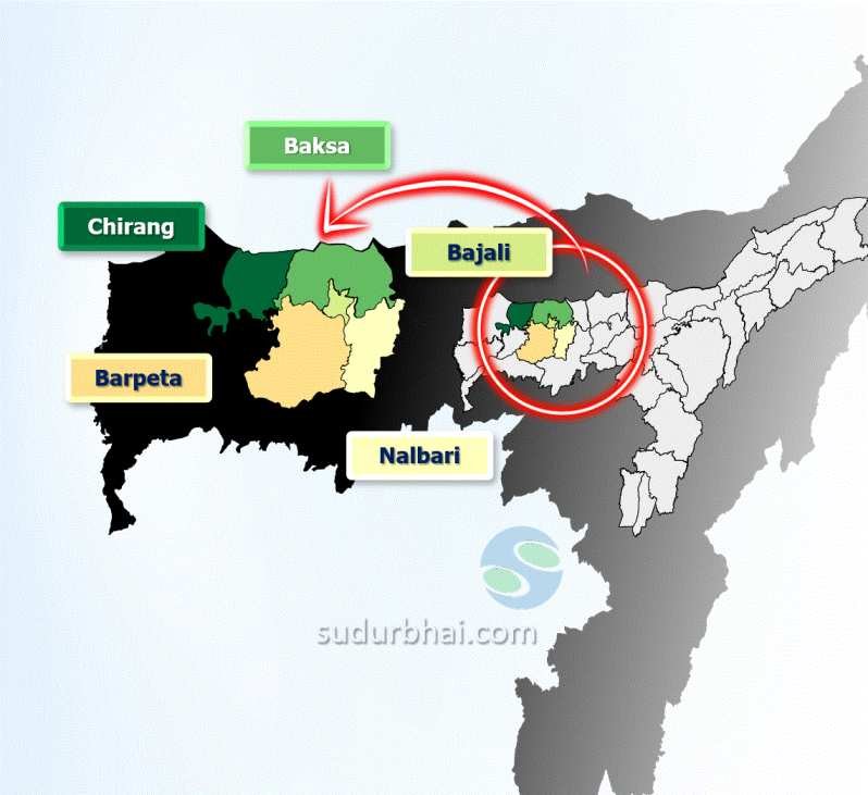
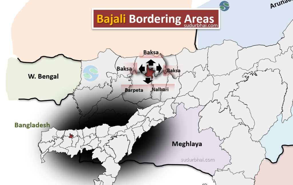
District Overview: Bajali
- Located in western Assam.
- Newly created district (Notification: Jan 2021 , Briefly revoked : December 2022 , Officially: Oct 2023).
- Boundaries:
- North: Baksa District
- East: Nalbari District
- West & South: Barpeta District
- Formerly a subdivision of Barpeta District.
- District HQ : Pathshala
Note: Pathsala is also referred to as Madan Rauta Nagar primarily due to its historical and cultural significance linked to the figure of Madan Rauta, a notable local leader and martyr associated with the Indian independence movement.
Geography of Bajali District
- Area: 422.95 sq km (163.30 sq mi), similar in size to Barbados.
- Rivers: Kaldia, Pahumara, Deojara, etc.
- Terrain: Primarily plains with scattered hills.
- Climate:
- Summer: Excessive humidity.
- Winter: Moderately cold and foggy (November to February).
- Dry period: February to April (moisture levels low).
- Rainfall: Heavy from May to September.
- Pleasant weather: October-November, foggy atmosphere till January.
- Dry and dusty: February-March.
Socio-Economy of Bajali District
- Main Economy: Agriculture (70% of the population dependent).
- Crops: Rice, Wheat, Maize, Jute, Potato, Mustard, Vegetables, Soyabean, Tobacco.
- Fruits : Mango, orange, Jackfruits, Lemon, Arecanut, coconut, Papaya etc.
- Soil & Climate: Favorable for agriculture with sufficient rainfall.
- Forestry: Significant role in economy, providing firewood, timber, bamboo, Ikra, thatch for daily needs and construction.
- Forest Type: Evergreen, with diverse tree species.
Transport in Bajali District
- Road Connectivity:
- NH-31 passes through the district.
- State Highway 127A connects to Bhutan.
- Road linking Bhawanipur to Manas National Park.
- Several arterial roads connect district headquarters to other centers.
- Rail Connectivity:
- Railway stations : Pathsala, Sarupeta and NizSariha.
- Road Connectivity:
Demographics of Bajali District
- Population (2011 Census): 324,739 (similar to Iceland).
- Population Density: 768 people per sq km.
- Growth Rate (2001-2011): 21.43%.
- Sex Ratio: 1002 females per 1000 males.
- Literacy Rate: 88.18%.
- Male : 93.12%
- Female : 83.26%
- Communities:
- Scheduled Castes: 7.56%.
- Scheduled Tribes: 4.52%.
- Religious Composition:
- Hindu: ~68%.
- Muslim: ~32%.
- Other religions: Very few.
- Languages:
- Official: Assamese and English.
- Majority: Assamese.
- Minority: Bodo, Bengali, Marwari, Bihari (microscopic minority).
Administrative Setup of Bajali District
- Revenue Circles: 2 (Bajali, Sarupeta).
- Development Blocks: 2 (Bajali, Bhawanipur).
- Gram Panchayats: 33.
- Villages: 212.
- Police Stations: 2.
- Municipal Boards: 2 (Pathsala, Patacharkuchi).
- Geographical Area: 422.95 sq km.
- Population: 395,000 (approx.).
- Literacy Rate: 71.03% (Male: 75.72%, Female: 64.04%).
- Major Rivers: 2 (Kaldia, Pahumara).
- Communication: Bus, Railway, and Airways.
Rainfall in Bajali District
- Cumulative Rainfall: 2761.76 mm (at Pathsala). [2022 data]
Attractive tourist places:
- Jalikhata (popularly known as Kalibari Than)
- Parihareswar Devalaya
- Gopal Ata Than
- Bamakhata Satra
- Bhogeswar Mandir, Ulua
- Pahumara Chapori
- Akaya Satra
Language spoken in Bajali :
The primary languages spoken in Bajali include:
- Assamese: 189,075 speakers
- Bengali: 53,052 speakers
- Boro: 10,877 speakers
- Other minority languages are also present but in smaller numbers
Let us know any further suggestions ,we at sudurbhai.com will be happy to hear from you in our comment section below !