
- Area: About 570 square kilometers.
- Boundaries:
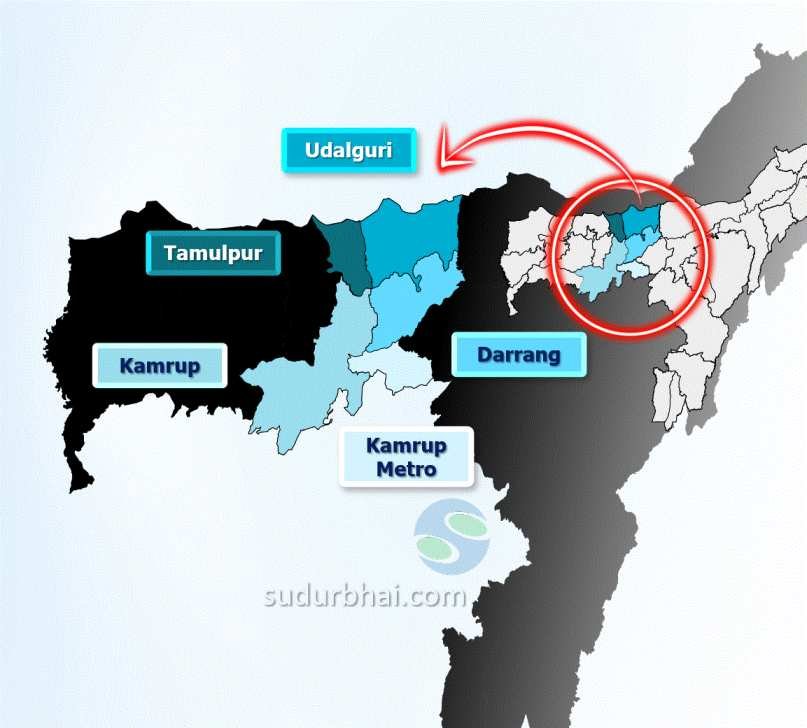
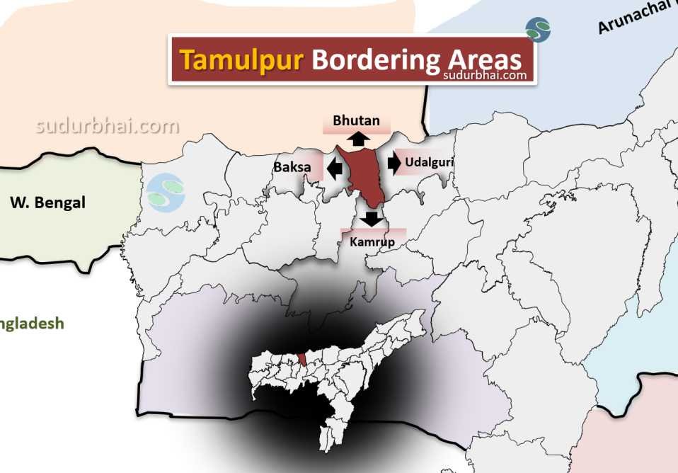
- North: Bhutan.
- South: Kamrup district.
- East: Udalguri district.
- West: Baksa district.
Tamulpur Neighbouring districts - Topography: A mix of flat plains and hilly terrains, with fertile agricultural land and wetlands.
- Climate: Humid subtropical, with hot summers and moderate winters.
- Annual Rainfall: Ranges between 2,500 mm to 3,000 mm, with the heaviest rainfall during the monsoon season.
- Impact: Heavy rainfall can cause flooding, but it also improves soil fertility, benefiting agriculture
- Rivers: Pagladia , Baralia , Puthimari and Barnadi.
