Bongaigaon District
INDEX
1. District Overview
2. History of Bongaigaon District
3. Geography of Bongaigaon District
4. Socio-Economy of Bongaigaon District
5. Transport in Bongaigaon District
6. Demographics of Bongaigaon District
7. Administrative Setup of Bongaigaon District
8. Tourist Places in Bongaigaon
9. Languages Spoken in Bongaigaon District
Overview of Bongaigaon District
Formation
- Established on September 29, 1989.
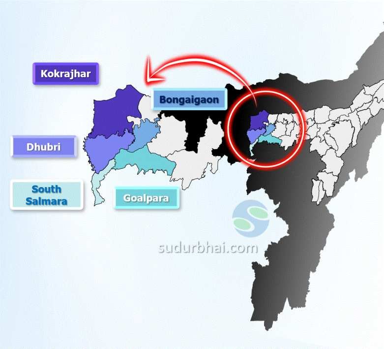
- Formed from parts of Goalpara and Kokrajhar districts to address political and administrative demands.
Headquarters
- Located in Bongaigaon town, an important industrial hub in Assam.
Area
- Covers approximately 1,093 square kilometers

History of Bongaigaon
Early History & Kingdoms
1. Bijni Kingdom (16th Century – 1956)
- Part of the Bijni Kingdom, ruled by Koch dynasty zamindars.
- Bijni royal family descended from Nara Narayan of the Kamata Kingdom.
- Ruled until the abolition of princely states in 1956.
2. Control by Bhutan (17th Century – 1865)
- Parts of present-day Bongaigaon fell under Bhutanese rule.
- 1865 Duar Wars: British forces expelled Bhutanese rulers.
- Integrated into the undivided Goalpara district.
British Colonial Era
1. Formation of Goalpara District (1822)
- British established Goalpara district, which included Bongaigaon.
- Administrative boundaries shifted, leading to the formation of Bongaigaon district later.
2. Duar Wars & Administrative Changes
- Post Duar Wars, British restructured local governance.
- 1874: Region became part of Assam Valley Province.
Geography of Bongaigaon District
- Location: Western part of Assam, India.
- Area: Approximately 1,093 square kilometers.
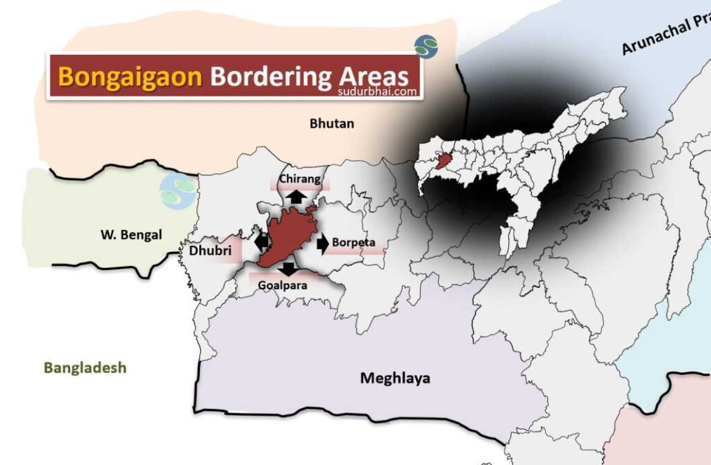
- Boundaries:
- North: Chirang
- East: Barpeta
- South: Goalpara
- West: Dhubri

Bongaigaon bordering districts
- Terrain: Mix of plains and hilly terrains.
- Beel : Dalani, Tamaranga, Kanora etc.
- Geographical Features: Rich biodiversity and fertile land, making it suitable for agriculture.
- Climate: Subtropical.
- Average Annual Rainfall: Ranges from 250 cm to 350 cm.
- Monsoon Season: Most precipitation occurs from June to September, supporting agricultural activities.
- Rivers: The Brahmaputra River (forming southern boundary) , Manas, Champamati, Aie, Mara Manas.

Socio-Economy of Bongaigaon District
- Economy: Primarily agrarian, with agriculture being the mainstay for most of the population.
- Main Crops: Rice, tea, jute, and various vegetables.
- Industrial Growth: Growing small-scale industries and manufacturing sector.
- Backward District: In 2006, Bongaigaon was identified as one of India’s 250 most backward districts, receiving special funding under the Backward Regions Grant Fund Programme.
Transport in Bongaigaon District
- Road and Rail Connectivity: Bongaigaon town serves as a transport hub.
- Rail Connectivity: The Bongaigaon Railway Station is a key junction on the North East Frontier Railway network.
[Only railway station in India below which a river flows (River Tunia)] - Public Transport: Buses and auto-rickshaws facilitate local travel.
Demographics of Bongaigaon District
Population
Total Population: 738,804
Males: 375,818
Females: 362,986
Population Growth (2001-2011): 20.59%
Sex Ratio
Overall Sex Ratio: 966 females per 1000 males
Child Sex Ratio (0-6 years): 969 girls per 1000 boys
Literacy Rate
Overall Literacy Rate: 69.74%
Male Literacy Rate: 74.87%
Female Literacy Rate: 64.43%
Religious Composition
Hindu: 48.61% (359,145)
Muslim: 50.22% (371,033)
Christian: 0.80% (5,924)
Sikh: 0.05% (384)
Buddhist: 0.03% (236)
Jain: 0.12% (871)
Scheduled Castes and Scheduled Tribes
Scheduled Castes (SC): Approximately 11.21%
Scheduled Tribes (ST): Approximately 2.55%
Urban vs Rural Population
Rural Population: Approximately 85.14%
Urban Population: Approximately 14.86%
Child Population
Total children aged 0-6 years: 116,392
Child population percentage: 15.75%
Administrative Setup of Bongaigaon District
- Formation: Created on September 29, 1989, carved out from parts of Goalpara and Kokrajhar districts.
- Administrative HQ: Bongaigaon town.
- Sub-Divisions: 3 (Bongaigaon (Sadar), North Salmara, and Manikpur).
- Revenue Circles and Development Blocks: 5 each.
Tourist Places in Bongaigaon District
- Bagheswari Temple: A significant religious site with historical importance.
- Eco-Park: A recreational area with natural beauty and outdoor activities.
- Suryapahar: An archaeological site with ancient ruins.
- Tea Gardens: Showcasing the region’s tea cultivation.
Languages Spoken in Bongaigaon District
- Assamese: 49.00%
- Bengali: 44.84%
- Bodo: 1.13%
- Hindi: 1.10%
- Kamtapuri: 1.45%
Let us know any further suggestions ,we at sudurbhai.com will be happy to hear from you in our comment section below !
