- Area: 1,685 square kilometers.
- Boundaries:
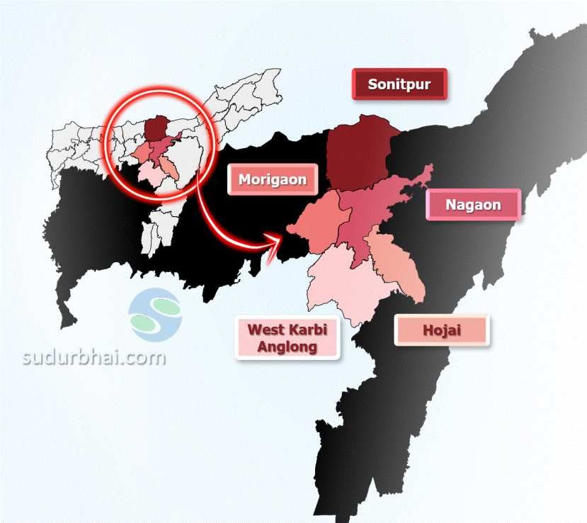
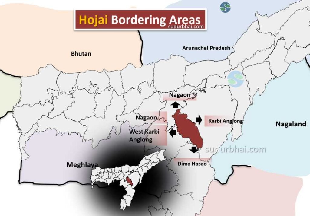
- North: Nagaon district.
- South: Dima Hasao district.
- East: East Karbi Anglong district.
- West: Nagaon , West Karbi Anglong districts.
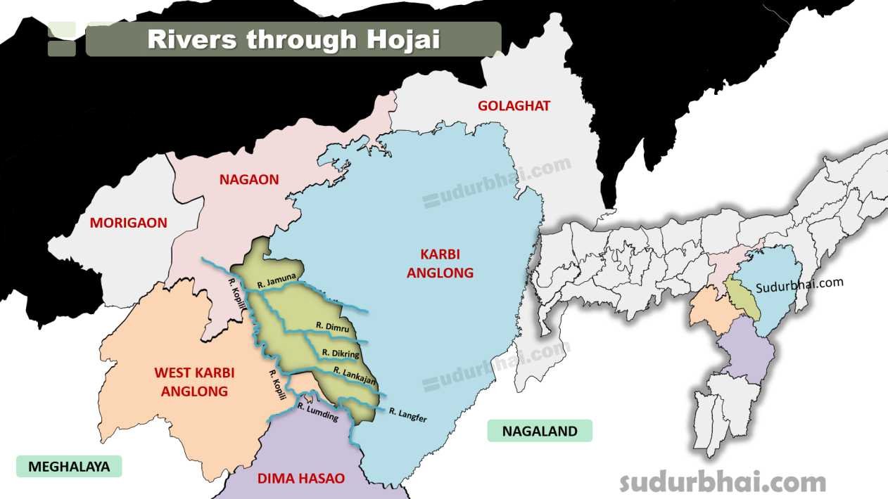
Hojai Neighbouring districts - Topography: The district features a mix of flat plains and hilly terrains, with rivers like the Kapili River flowing through it.
- Climate: Humid subtropical climate with an annual rainfall of around 2,500 mm (mostly during monsoon from June to September).
- Rivers – Kopili , Jamuna, Dikring , Langfer.