Charaideo District

Charaideo District

INDEX

1. District Overview
2. History of Charaideo District
3. Geography of Charaideo District
4. Socio-Economy of Charaideo District
5. Transport in Charaideo District
6. Demographics of Charaideo District
7. Administrative Setup of Charaideo District
8. Tourist Places in Charaideo District
9. Languages Spoken in Charaideo District

  District Overview of Charaideo District

  • Location: Eastern Assam, India.
  • Established: August 15, 2015 (carved out from Sivasagar district).
  • Historical Significance: First capital of the Ahom kingdom, founded by Chao Lung Siu-Ka-Pha in 1253 CE.
  • Name Meaning: “The shining city on the hills” in Tai-Ahom language.

  History of Charaideo District

Establishment as Capital

    • Founded in 1253 CE by Chao Lung Siu-Ka-Pha, the first Ahom king.
    • Served as the first capital of the Ahom kingdom.
    • Though the capital shifted over time, Charaideo remained the symbolic center of Ahom power & culture.

Etymology

    • Derived from Tai-Ahom words Che-Rai-Doi meaning “Shining City on the Hills.”
    • Name reflects its geographical & historical prominence.

Historical Context

    • Pre-Ahom Era:
      • Originally a worship site for Moran & Borahi tribes.
      • Transformed into an important settlement under Sukapha, blending local & Tai-Ahom traditions.
    • Burial Practices:
      • Ahoms practiced elaborate royal burials, including personal items & servants in tombs.
      • Reflects beliefs in the afterlife and unique cultural death rituals.

  Geography of Charaideo District

  • Area: Approximately 1,069.15 square kilometers.
  • Boundaries:
    • North: Dibrugarh district
    • South: Nagaland and Arunachal Pradesh.
    • West: Sivasagar district.
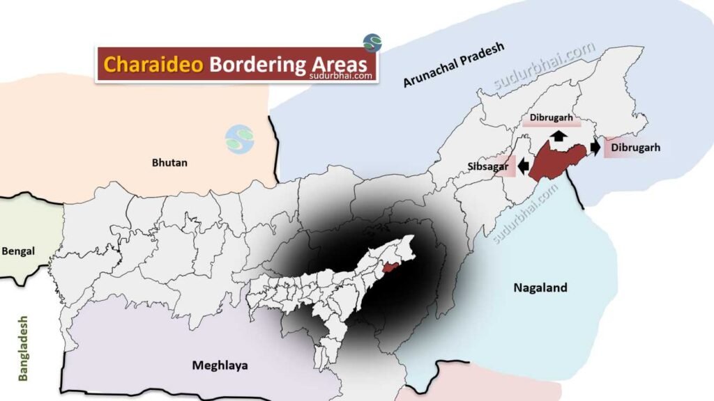
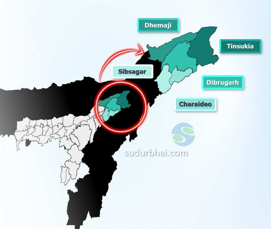
  • Topography:
    • Hilly landscapes with valleys and rivers.
  • Major rivers: Desang, Towkak, Suffry, Timon, and Teok.
  • Biodiversity: Rich diversity due to varied geography, contributing to fertile agricultural land.
  • Climate: Subtropical monsoon climate.
  • Average Annual Rainfall: Approximately 2,500 mm.

  Socio Economy of Charaideo District

  • Economy: Primarily agrarian, with a focus on farming.
  • Key Agricultural Products: Rice, tea, and various fruits and vegetables.
  • Industries: Small-scale industries and handicrafts also provide local employment.
  • Challenges: Infrastructure development and access to markets remain significant challenges despite agricultural potential.

  Transport of Charaideo District

  • Connectivity: Well-connected by road and rail.
  • Main Town: Sonari, serves as a transport hub with links to major highways.
  • Railway Station: Simaluguri, connects the district to broader railway networks.
  • Public Transport: Buses and auto-rickshaws facilitate local travel.

  Demographics of Charaideo District

Population Statistics

    • Total Population: 471,418

      • Males: 234,543 (49.7%)

      • Females: 224,072 (50.3%)

    • Sex Ratio: 955 females per 1000 males

Urban and Rural Distribution

    • Urban Population: 29,723 (6.31%)

    • Rural Population: 428,695 (93.69%)

Age Distribution

    • Children (0-6 years): 60,889

    • Population aged 7 years and above: 397,726

Literacy Rate

    • Overall Literacy Rate: 71%

      • Literates: 294,762

      • Illiterates: 102,964

Scheduled Castes and Scheduled Tribes

    • Scheduled Castes: 7,643 (1.62%)

    • Scheduled Tribes: 11,909 (2.53%)

Religious Composition

    • Hinduism: 88.00%

    • Christianity: 5.24%

    • Islam: 4.58%

    • Other tribal religions: 1.25%

    • Buddhism: 0.72%

    • Others/not stated: 0.21%

 Administrative Setup of Charaideo District

  • Formation: Carved from Sivasagar district on August 15, 2015.
  • Administrative HQ: Located in Sonari.
  • Sub-Division: 1.
  • Revenue Circles: 4 (Sonari, Sapekhati, Mahmora, Nazira).
  • Development Blocks: 4.
  • Towns: 2 (Sonari Municipality Board, Moran Town Committee).

 Attractive Tourist places of Charaideo District

  • Charaideo Maidam: Burial mounds of Ahom kings, resembling pyramids. These are important archaeological sites which was granted the UNESCO World Heritage Site status on July 26, 2024.
  • Borhat Bazar: A historical market area with cultural significance.
  • Raja Pukhuri: A scenic water body ideal for relaxation.
  • Temples:
    • Sri Sri Haridev Bornamghar
    • Cholapathar Shyam Gaon Buddhist Monastery.
    • Borpatra Pukhuri

 Languages spoken in Charaideo District

    • Assamese: 75.64% of the population
    • Sadri: 7.64%
    • Bengali: 4.22%
    • Odia: 3.20%
    • Hindi: 1.92%
    • Nepali: 1.38%

Let us know any further suggestions ,we at sudurbhai.com will be happy to hear from you in our comment section below ! 

Leave a Comment

Your email address will not be published. Required fields are marked *

Scroll to Top