- Area: Approximately 5,324 square kilometers.
- Coordinates: Around 26°38′ N latitude and 92°48′ E longitude.
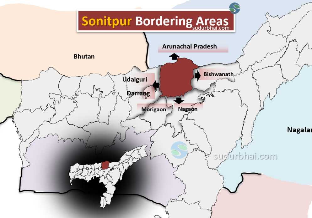
- Boundaries:
- North: Arunachal Pradesh.
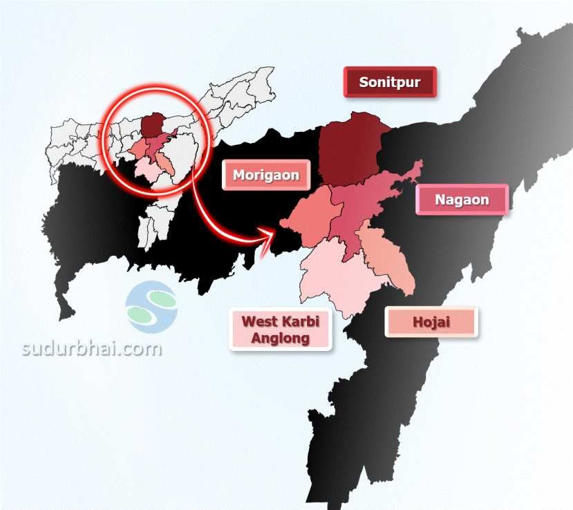
- South: Morigaon, Nagaon
- East: Bishwanath.
- West: Udalguri , Darrang district.
Sonitpur Neighbouring districts - Topography: The district features fertile plains along the Brahmaputra River and hilly terrains in the northern parts.
- Climate: Subtropical climate with hot summers and mild winters. Average rainfall is about 2,500 mm, mainly during the monsoon season (June to September).
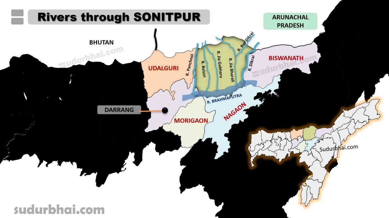
- Rivers: Brahmaputra (in southern Border), Jiabharali,Belsiri, Gabharu, and Dikrai.