- Area: 1,824 square kilometers.
- Boundaries:
- North: Bongaigaon, Borpeta.
- South: Meghalaya (Garo Hills).
- East: Kamrup district.
- West: Dhubri, South-salmara Manchachar district.
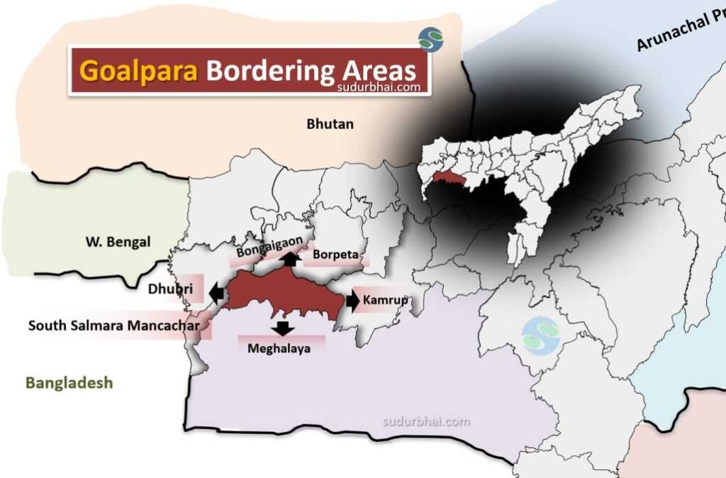
Goalpara bordering districts
- Major physiographic zones:
Zone
Description
Northern Alluvial Plains Fertile land along the Brahmaputra, ideal for agriculture. Southern Hills Part of the Meghalaya Plateau, with rugged terrain and forests. Riverine Floodplains Low-lying areas prone to seasonal flooding. - Beels: Urpad , Nalga, Kumri etc.
- Climate: Humid Subtropical Climate
- Summer (March–June): Hot and humid, temperatures range from 25°C to 35°C.
- Monsoon (June–September): Heavy rainfall due to the Southwest Monsoon, annual precipitation around 2200-2800 mm.
- Winter (November–February): Cool and dry, temperatures range from 10°C to 22°C
- Land Use Pattern in Goalpara:
Category Percentage of Total Land Agricultural Land 55% Forest Cover 20% Water Bodies 10% Others (Urban/Rural Settlements, Grasslands, etc.) 15%
- Land Use Pattern in Goalpara:
- Agriculture in Goalpara :
Category Major Crops Cereals Paddy, Wheat, Maize Oilseeds Mustard, Sesame Pulses Lentils, Gram, Peas Cash Crops Jute Horticultural Crops Areca Nut, Banana, Vegetables - Forests and Vegetation:
- Goalpara has a mix of dense forests and open grasslands, particularly in the southern region.
- Major forest types:
- Tropical Moist Deciduous Forests
- Evergreen and Semi-evergreen Forests in hilly areas
- Important Wildlife Areas:
- Dudhnai Reserve Forest (Rich in biodiversity, home to various flora and fauna).
- Hulukanda Forest (Known for its population of Hoolock Gibbons).
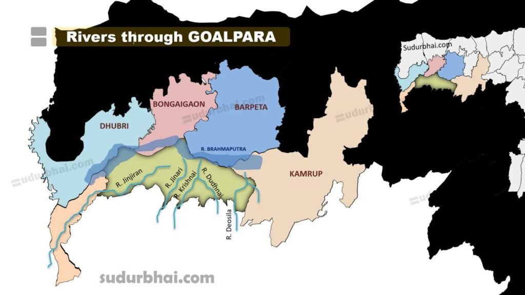
- Rivers : Brahmaputra (northern border), Dhudhnoi , Krishnai, Deosila, Jinjiran.
- Agriculture in Goalpara :